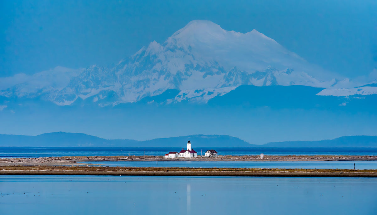
Making the Trek out to the New Dungeness Spit Lighthouse
|
Time to read 4 min
|
Time to read 4 min
The Dungeness Spit is a wonderful beach formation full of wildlife and ocean sounds found just north of Sequim in Washington State. It was formed over many years from sand eroding from cliffs to the southwest combined with a river to the east. What is left is a narrow strip of land that extends out more than 5 miles (and growing!) into the Strait of Juan de Fuca. Of course, the tip of this land would be the perfect spot for the New Dungeness Lighthouse and a great goal for a beach hike!
I lived in the area during the 6th grade and visited this area several times. Maybe due to my age, endurance, or willingness of my parents, I never found myself making the 10 mile out-and-back to see the lighthouse up close. We'd hike down to the beach from the upper parking lot and play around in the sand then return to the car.
I finally returned this year and decided that I was going to make the trek to the end. The tide was low, a requirement to make the last portion to the lighthouse that can be underwater in normal to high tide times.
The hike begins up in the parking lot. There's a small fee to pay ($3 when I was there in 2023) then it's off into the woods on the way to the cliff edge for a great overview look of the spit, ocean, lighthouse and sometimes Mount Baker in the distance. The day I was there, I got a great view of the New Dungeness Lighthouse and mountain with my 600mm telephoto lens as seen in the leading image in this post.
A quick descent and you are standing on the beach with a view of the Olympic Mountains to the South and what seems to be an endless beach spanning north into the distance.
From there, it's a sandy hike along the waterfront on the ocean side. The lagoon side to the east is off-limits to protect the wildlife. You can pop up there on the driftwood and have a look but then continue back on the ocean side to the New Dungeness Lighthouse.
After about an hour, I realized that the hike would be much better with a friend. Alone, I became somewhat bored with unchanging scenery: beach waves to the left, sand at my feet, driftwood up to the right, and, for most of the hike, no end in sight. I suppose I'm just used to winding forest trails, streams, rock scrambles... that's my jam.
I found some cool views on the beach including a starfish and rocks that made cool patterns from retreating waves. As I plowed along, I noticed many inquisitive seagull perching on the driftwood with the grand Olympic Mountain Range behind. There were many other interesting birds hanging out on the lagoon side hunting fish or just chilling in the calmness. I enjoyed the contrast between the high-energy side facing the strait and the protected, mellow side.
Just after the 1/2-way-out-mark, the trail takes a bend and and the New Dungeness Lighthouse becomes visible. It's still small but now there's a target. To my left, over the strait, Vancouver Island and the San Juan Islands can be seen.
I knew the real goal of this hike was to get the alignment of the lighthouse and the volcano which isn't possible this far out so I increased my pace to visit the New Dungeness lighthouse and then make the return trip as fast as possible to prepare for the sunset photo I wanted and then sprint back to the car before the gates were locked.
The sun was getting low so I hightailed it back to the mainland. Again, without the a winding trail crossing streams, dodging roots, and other distractions, the time seemed to drag on with a destination far in the distance. I finally made it to the trailhead just before sunset but the haze in the distance entirely obstructed the view of Mount Baker. The initial photo I took at the beginning turned out the best but this hike is now on my list of "return and try again" for a sunset version. I still do like the blue sky version in the gallery right now. Head over to to my print gallery to check out sizing and pricing. Happy hiking!


